 |
Photos - Chamonix-Mt.Blanc (France) |
|
Mount Blanc is the highest mountain in Western Europe. Its 4,807-meter-high peak lies in the ridgeline of the Pennine Alps and the peak defines the border between France and Italy. Its name means "White Mountain" in French, though in earlier centuries, it was also known as Mont Maudit, or the "Accursed Mountain".
The region is old enough to have been deeply cut in areas by riverine and glacial erosion, in places exposing the base rock of the original protocontinent, which is around 400 million years old. The high permanent snowpack of the mountains feeds glaciers which carve characteristic U-shaped valleys throughout the area. There is over 100 square kilometers (40 square miles) of glaciers in the region feeding into the Chamonix valley on the French side. If you are planning to visit Chamonix and the Mont Blanc massif you may be interested in having a quick look at several photos of this area. Click on the links at right to view the pictures. We have taken any attempt to provide exact (GPS-based) coordinates of the positions where the photos have been taken. |
|
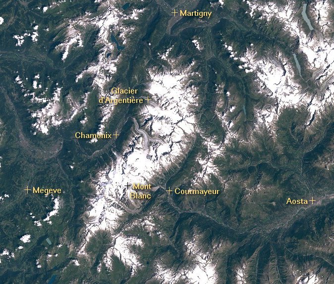
 Here you see the Mont Blanc massif from space. Image courtesy of Earth Sciences and Image Analysis Laboratory, NASA Johnson Space Center. |
Grandes Jorasses and Dent du Géan Dent du Géant Grandes Jorasses Rochefort Ridge Mont Blanc Glaciers near Chamonix Argentière Valley Ascent to Aiguille d'Argentière Aiguille Verte Aiguille Verte and Mont Blanc Mont Blanc and Dent du Géan Arrête des Cosmiques from Aiguille du Midi Kuffner Ridge Rochefort Ridge CloseUp See also: Mont Blanc from Space |