 |
Chamonix-Mt.Blanc: Mont Blanc and Dent du Géan |
Album Overview
Photo Index
  |
|
More photos in the vicinity: Grandes Jorasses Rochefort Ridge Rochefort Ridge CloseUp |
The ridge that leads to the rock tower (on the right) is called Arête de Rochefort. The tower itself is Dent du Géant (the giant's tooth). Mont Blanc is in the back. The rock formation on the left is the famous Aiguille Noire de Peuterey |
|
|
Date: Jul 27, 2004 Longitude: 6° 57.61' Latitude: 45° 51.85'  
Show Photo Position in Google Maps |
||
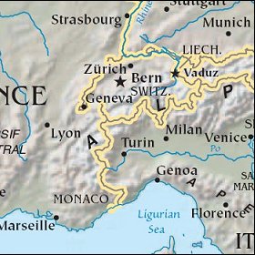
   Map references: left: courtesy CIA, middle: courtesy US LoC Map Collection, right: courtesy NASA. This page has been updated on: 2007-Nov-07 |
||