 |
Bretagne: Binic |
Album Overview
Photo Index
  |
|
More photos in the vicinity: Harbour of Binic Outskirts of Binic Bay close to Binic before Les Godelins |
Arrival at low tide at Binic in the late afternoon. |
|
|
Date: Jun 08, 2008 Longitude: -2° 48.76' Latitude: 48° 35.56'  
Show Photo Position in Google Maps |
||
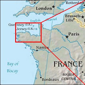 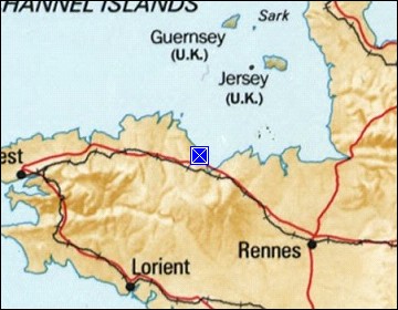 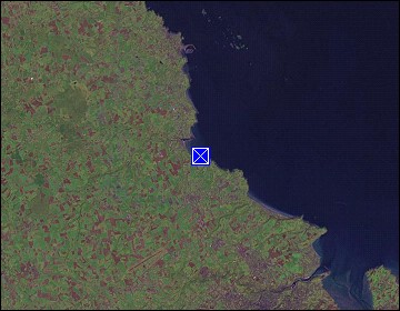 Map references: left: courtesy CIA, middle: courtesy US LoC Map Collection, right: courtesy NASA. This page has been updated on: 2009-Feb-03 |
||