 |
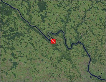
Upper Austria: Danube at Schlögen |
Album Overview
Photo Index
  |
|
More photos in the vicinity: Danube at Schlögen Castle of Marsbach Castle of Marsbach |
At Schlögen the Danube carved a 180 turn into the granite of this area, flowing for 2 kilometers in the opposite direction. Here we stand at the bank of the first bow (the water comes from the left, turns right and flows back). |
|
|
Date: Oct 07, 2007 Longitude: 13° 52.36' Latitude: 48° 25.50'  
Show Photo Position in Google Maps |
||
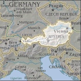   Map references: left: courtesy CIA, middle: courtesy LOC map collection, right: courtesy NASA. This page has been updated on: 2007-Nov-06 |
||