 |
La Palma: Church of Santo Domingo |
Album Overview
Photo Index
  |
|
More photos in the vicinity: House at the Main Square of Garafía Garafía seen from Above Market at El Fayal (Puntagorda) |
Santo Domingo is the main village (capital) of the municipality Garafía. Here we look at the church of S. Domingo.  |
|
|
Date: Aug 12, 2007 Longitude: -17° 56.70' Latitude: 28° 49.83'  
Show Photo Position in Google Maps |
||
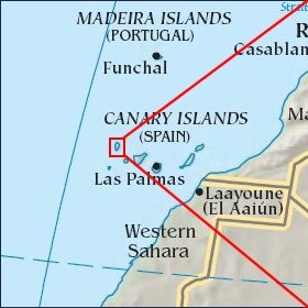 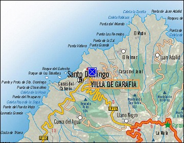 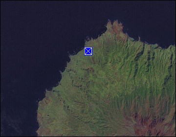 Map references: left: courtesy CIA, middle: courtesy Cicar, right: courtesy NASA. This page has been updated on: 2007-Nov-06 |
||