 |
La Digue: Northernmost Point of La Digue |
Album Overview
Photo Index
  |
|
More photos in the vicinity: Félicité seen from Anse Patates Palm Tree Spider |
 |
|
|
Date: Feb 01, 2007 Longitude: 55° 50.02' Latitude: -4° 20.28'  
Show Photo Position in Google Maps |
||
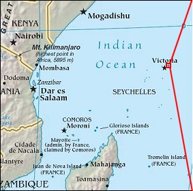 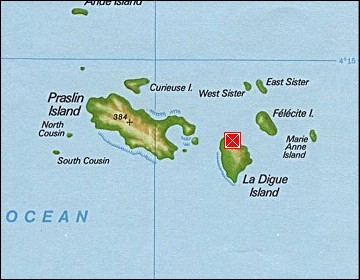 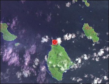 Map references: left: courtesy CIA, middle: courtesy US LoC Map Collection, right: courtesy NASA. This page has been updated on: 2007-Nov-08 |
||