 |
La Digue: L'Union Estate Cementary |
Album Overview
Photo Index
  |
|
More photos in the vicinity: Oxcart Land Tortoise L'Union Estate National Park |
Here we see the old abandoned cementary of the first French settlers at La Digue. |
|
|
Date: Jän 30, 2007 Longitude: 55° 49.50' Latitude: -4° 21.76'  
Show Photo Position in Google Maps |
||
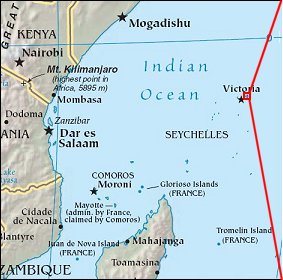 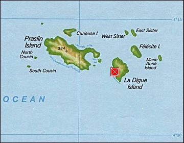  Map references: left: courtesy CIA, middle: courtesy US LoC Map Collection, right: courtesy NASA. This page has been updated on: 2007-Nov-08 |
||