Egypt
 |
Alexandria (Al Iskandariya) (Egypt) occupies a T-shaped peninsula and strip of
land separating the Mediterranean from Lake Mariout.
Originally the town was built upon a mole (stone breakwater)
called Heptastadium,.... ....read more |
 |
This Envisat ASAR Wide-Swath radar multicolour composite image is focused over the capital city of Cairo, Egypt, seen as a large bright area centre left of the image. The River Nile crosses the image from south to north separating the Libyan Desert or Western Desert, a part of the Sahara, from the Arabian Desert.... ....read more |
 |
One of the world’s largest artificial lakes, Lake Nasser (Egypt) is named after the Egyptian President Gamal Abdul Nasser, who is largely responsible for the lake’s creation. President Nasser decided to build the Aswan High Dam across the Nile, forming a lake approximately 550 kilometers (340 miles) long..... ....read more |
 |
Cycles of flood and drought in the African Sahel are legendary, and they have provided the impetus for major waterworks on Africa’s great rivers. The construction of the Aswan High Dam on the Nile River, creating Lake Nasser (Egypt) in the 1960s, is the biggest and most visible project..... ....read more |
 |
The Nile Delta, Cairo (Egypt), the Pyramids, the upper Suez Canal, and the
entire eastern Mediterranean Sea lay behind the Challenger during a descending
orbit. Dust from an easterly wind lay over the waters between Turkey and the island
of Cyprus. ....read more |
 |
This oblique photograph captures a northbound convoy of
cargo ships entering the Mediterranean Sea from the Suez Canal
in Egypt (leftmost canal branch at image center). ....read more |
 |
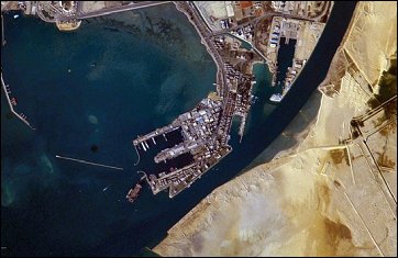
The Port of Suez is located in Egypt along the northern coastline of the Gulf of
Suez. The port and city mark the southern terminus of the Suez Canal, which runs north-south through Egypt
from the Mediterranean Sea to the Gulf of Suez..... ....read more |


 Home
Home