 |
Gran Canaria: Roque Bentaiga and Pico de Teide |
Album Overview
Photo Index
  |
|
More photos in the vicinity: Valley of La Culata Volcanic Erosion The Peaks of the Canaries |
The high mountain trail above the ground haze offers a great view on the fantastic rock formations and hills of Gran Canaria. In the background Tenerife can be seen. |
|
|
Date: Nov 23, 2004 Longitude: -15° 35.41' Latitude: 27° 58.85'  
Show Photo Position in Google Maps |
||
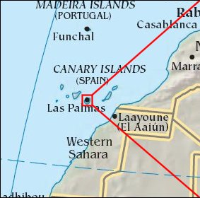 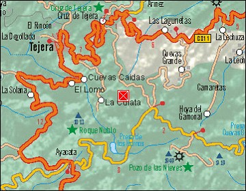  Map references: left: courtesy CIA, middle: courtesy Cicar, right: courtesy NASA. This page has been updated on: 2007-Nov-08 |
||