 |
Upper Austria: Lake Attersee seen from Lichtenberg |
Album Overview
Photo Index
  |
|
More photos in the vicinity: Dachstein and Schafberg seen from Lichtenberg Traunstein, Attersee and Höllengebirge Attersee and Traunstein |
The Attergauer Aussichtsturm at Lichtenberg offers a splendid view of its surroundings. Here we are looking towards southeast. From left to right we see Traunstein (1691 m), Kasberg, Großer Priel, and Feuerkogel. Lake Attersee is in front. |
|
|
Date: Oct 24, 2004 Longitude: 13° 25.55' Latitude: 47° 55.96'  
Show Photo Position in Google Maps |
||
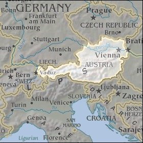   Map references: left: courtesy CIA, middle: courtesy LOC map collection, right: courtesy NASA. This page has been updated on: 2007-Nov-06 |
||