 |
Gibraltar: Harbour of Gibraltar and La Linea |
Album Overview
Photo Index
  |
|
More photos in the vicinity: La Linea seen from Moorish Castle The Bay of Gibraltar Africa seen from Gibraltar |
 |
|
|
Date: Aug 17, 2006 Longitude: -5° 20.97' Latitude: 36° 8.63'  
Show Photo Position in Google Maps |
||
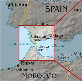 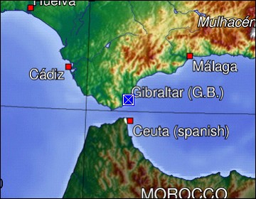 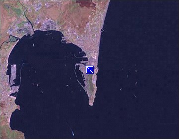 Map references: left: courtesy CIA, middle: generated by GMT, right: courtesy NASA. This page has been updated on: 2007-Nov-08 |
||