 |
The Way of St James: Seyssel |
Album Overview
Photo Index
  |
|
More photos in the vicinity: Between Seyssel and Culoz Chemin de la Pêche Motz |
A small town on the banks of the River Rhône - suspension bridge built in the XIXth century topped by a statue of the Virgin Mary protecting the boatmen.  |
|
|
Date: May 08, 2007 Longitude: 5° 49.92' Latitude: 45° 57.58'  
Show Photo Position in Google Maps |
||
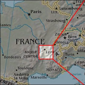   Map references: left: courtesy CIA, middle: courtesy US LoC Map Collection, right: courtesy NASA. This page has been updated on: 2008-Feb-21 |
||