 |
Mongolia: Ider Valley |
Album Overview
Photo Index
  |
|
More photos in the vicinity: Ancient Grave Graveyard of an Ancient Army Cargo Caravan |
The Ider river is one of the many tributaries of the Selenge Moron river system. |
|
|
Date: Jul 21, 2004 Longitude: 98° 55.35' Latitude: 48° 40.57'  
Show Photo Position in Google Maps |
||
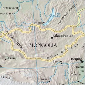   Map references: left: courtesy CIA, middle: courtesy US LoC Map Collection, right: courtesy NASA. This page has been updated on: 2007-Nov-08 |
||