 |
Mongolia: Hoyd Tamir |
Album Overview
Photo Index
  |
|
More photos in the vicinity: Landscape near Tsetserleg Wrestler's Rock Wrestler's Rock |
This small river called Hoyd Tamir is one of the many tributaries of Orghon Gol, one of the larger rivers in northern Mongolia. This river (as most of Mongolias waters) finally drain into the arctic ocean.  |
|
|
Date: Jul 18, 2004 Longitude: 101° 12.76' Latitude: 47° 35.15'  
Show Photo Position in Google Maps |
||
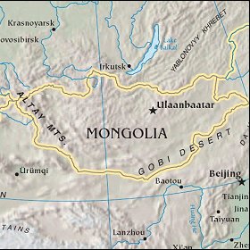 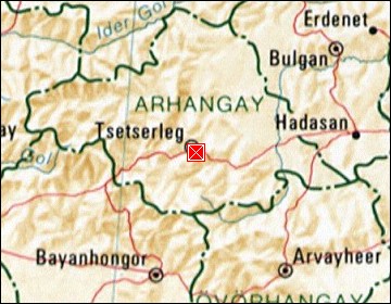  Map references: left: courtesy CIA, middle: courtesy US LoC Map Collection, right: courtesy NASA. This page has been updated on: 2007-Nov-08 |
||