| Earth from Space is a free eBook describing our planet from a satellite's perspective. Fore more information, please read the About pages. |

|

Home  North America North America  USA USA  California California  San Francisco San Francisco |
|
| See also: San Francisco Bay | |


|
|
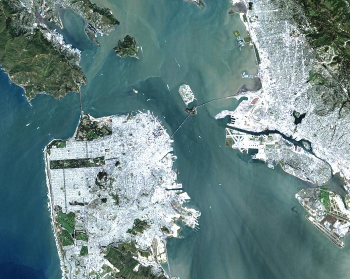
San FranciscoPosition of center of photo (Lat/Long): [37.78738/-122.38930] |
|
  On a rare fog free day Landsat 7 flew over San Francisco (United States) and produced this stunning true color image. You can easily see both man made structures - the Golden Gate Bridge On a rare fog free day Landsat 7 flew over San Francisco (United States) and produced this stunning true color image. You can easily see both man made structures - the Golden Gate Bridge

|
| Source of material: NASA |
Further information: WikiPedia article on San Francisco
Last Update: 2011-03-30

