| Earth from Space is a free eBook describing our planet from a satellite's perspective. Fore more information, please read the About pages. |

|
Home  Central America and Caribbean Yucatan, Guatemala and El Salvador Central America and Caribbean Yucatan, Guatemala and El Salvador |
|
| See also: Santa Maria Volcano, Volcanoes near Usulután | |


|
  |
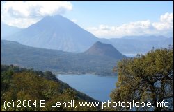
Yucatan, Guatemala and El SalvadorPosition of center of photo (Lat/Long): [17.32637/-90.22779] |
|
  The effectiveness of modern tree-cutting technology became clear to archaeologist Tom Sever in the late 1980s. NASA and the National Geographic Society hired him to study the potential impact of a hydroelectric dam on the Usumacinta River in Guatemala. Sever, who had pioneered the use of remote-sensing data in finding archaeological sites, turned to satellite imagery once again. Using Landsat data, he produced an image showing part of the border between Guatemala and Mexico. Most political borders are invisible in satellite images, but this border was obvious. The rainforest - still intact in Guatemala - stopped abruptly at the Mexican border, where the landscape had been stripped. The image above shows a larger area, however, the abrupt change of vegetation at the Mexcan border (center of the image) is still clearly visible. The effectiveness of modern tree-cutting technology became clear to archaeologist Tom Sever in the late 1980s. NASA and the National Geographic Society hired him to study the potential impact of a hydroelectric dam on the Usumacinta River in Guatemala. Sever, who had pioneered the use of remote-sensing data in finding archaeological sites, turned to satellite imagery once again. Using Landsat data, he produced an image showing part of the border between Guatemala and Mexico. Most political borders are invisible in satellite images, but this border was obvious. The rainforest - still intact in Guatemala - stopped abruptly at the Mexican border, where the landscape had been stripped. The image above shows a larger area, however, the abrupt change of vegetation at the Mexcan border (center of the image) is still clearly visible.
|
| Source of material: NASA |
Further information: WikiPedia article on Yucatan, Guatemala and El Salvador
Last Update: 2011-03-30