| Earth from Space is a free eBook describing our planet from a satellite's perspective. Fore more information, please read the About pages. |

|

Home  South America South America  Chile Chile  Chaitén Volcano Chaitén Volcano |
|
| See also: Town of Chaitén after the Eruption | |


|
|
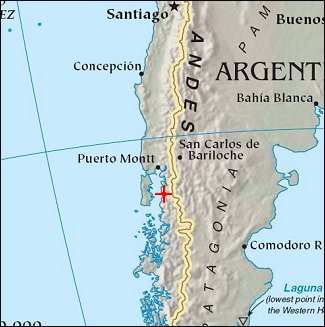
Chaitén VolcanoPosition of center of photo (Lat/Long): [-42,941/-72,714] |
|
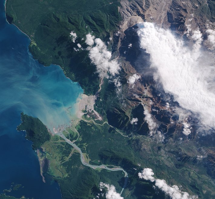
  Perhaps one of nature’s greatest displays of power is an erupting volcano. Towering clouds of ash and steam, intense heat, fast-moving landslides, and flowing lava are a just a few of the many life-threatening hazards of a volcanic eruption. The power and danger are at once frightening and fascinating. Satellites provide a detailed and comprehensive view of an eruption from the safety of hundreds of kilometers away. These images, from the Advanced Land Imager on the EO-1 satellite, show the ongoing eruption of Chile’s Chaitén Volcano. Perhaps one of nature’s greatest displays of power is an erupting volcano. Towering clouds of ash and steam, intense heat, fast-moving landslides, and flowing lava are a just a few of the many life-threatening hazards of a volcanic eruption. The power and danger are at once frightening and fascinating. Satellites provide a detailed and comprehensive view of an eruption from the safety of hundreds of kilometers away. These images, from the Advanced Land Imager on the EO-1 satellite, show the ongoing eruption of Chile’s Chaitén Volcano.
The image shows the volcano and its surroundings in photo-like true color. The Chaitén Volcano is a relatively small, tan mound near the top of the image. A white plume, likely composed of steam and possibly ash, rises from the volcano.
|
| Source of material: NASA |
Further information: WikiPedia article on Chaitén Volcano
Last Update: 2011-03-30


