 |
Swiss Alps: Ascent to Mönch |
Album Overview
Photo Index
  |
|
More photos in the vicinity: Jungfraufirn Jungfrau Track from Jungfraujoch to Mönchsjoch |
The ascent to Mönch is relatively easy during summer, but we did not make it to the summit in winter. Looking down to Mönchsjoch you can spot a helicopter taking material to the Mönchsjochhütte (a mountain hut). |
|
|
Date: Feb 04, 2004 Longitude: 8° 0.14' Latitude: 46° 33.25'  
Show Photo Position in Google Maps |
||
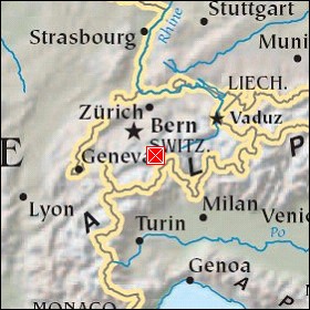  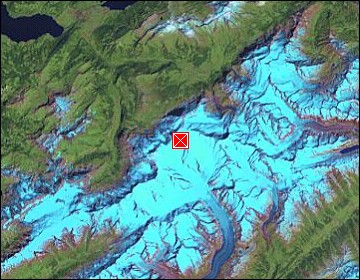 Map references: left: courtesy CIA, middle: courtesy US LoC Map Collection, right: courtesy NASA. This page has been updated on: 2007-Nov-08 |
||