 |
Central Guatemala: The Outskirts of Guatemala City from Air |
Album Overview
Photo Index
  |
|
More photos in the vicinity: Guatemala City with the Volcanoes Fuego and Acatenango Market Typical Grocery Store |
The outskirts of Guatemala City are restricted by deep gorges. In the background you see the Volcán de Agua at left and the Volcán de Fuego (with plume) and the Volcán Acatenango at the right. |
|
|
Date: Jän 05, 2005 Longitude: -90° 33.27' Latitude: 14° 43.08'  
Show Photo Position in Google Maps |
||
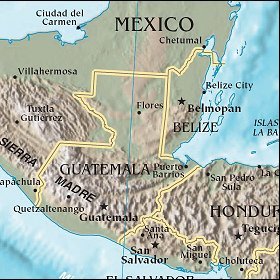   Map references: left: courtesy CIA, middle: courtesy US LoC Map Collection, right: courtesy NASA. This page has been updated on: 2007-Nov-08 |
||