 |
Central Guatemala: San Pedro at the Lago de Atitlán |
Album Overview
Photo Index
  |
|
More photos in the vicinity: At the Shore of Lago de Atitlán Villas at the Lago de Atitlán Yucca Palm Trees |
The volcano at the left is called Volcán San Pedro and dominates with its 3000 m the southwest end of lake Atitlán. |
|
|
Date: Dec 27, 2004 Longitude: -91° 10.27' Latitude: 14° 40.49'  
Show Photo Position in Google Maps |
||
 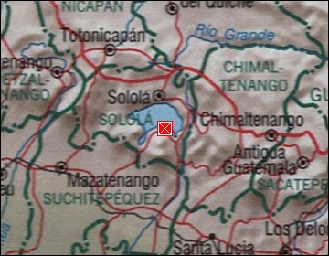 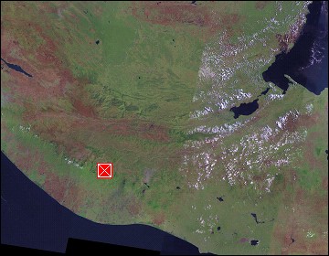 Map references: left: courtesy CIA, middle: courtesy US LoC Map Collection, right: courtesy NASA. This page has been updated on: 2007-Nov-08 |
||